
The New Construction Infrastructure Pipeline: Where New Subdivisions Could Expand Next in South Metro Atlanta
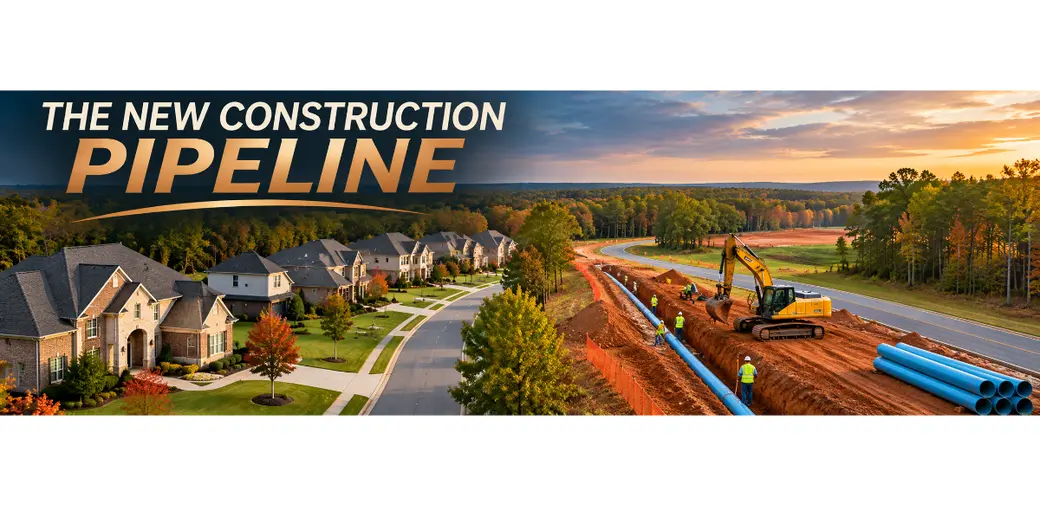
The New Construction Infrastructure Pipeline: Where New Subdivisions Could Expand Next in South Metro Atlanta
Tracking Utilities and Water Extension Lines: Where New Subdivisions Will Expand Next
What if one of the earliest clues about future neighborhood growth isn't a new subdivision sign, a model home, or a construction crew?
What if it's a water line?
When people think about new construction, they often focus on available land, home prices, and building activity.
But long before a new neighborhood takes shape, developers must consider something less visible:
The infrastructure needed to support it.
Water service, sewer capacity, road access, stormwater management, and other public facilities can influence where residential development is feasible.
For buyers, landowners, and investors watching McDonough, Hampton, Stockbridge, Locust Grove, and surrounding Henry County communities, understanding these infrastructure decisions can provide valuable insight into potential growth.
Let's explore how utility extensions can influence new construction, where to find development information, and what to investigate before making a real estate decision.
1. Why Infrastructure Matters Before a Subdivision Is Built
A beautiful parcel of land may look like the perfect location for a future neighborhood.
But appearance alone doesn't determine whether it can support residential construction.
Developers must evaluate the availability, capacity, cost, and approval requirements of essential infrastructure.
Water Service
New homes require an approved water supply.
Developers may need to determine whether an existing water main can serve a proposed subdivision or whether additional infrastructure is necessary.
The presence of a nearby water line doesn't automatically mean the property has sufficient service capacity.
Sewer Availability
Wastewater infrastructure can be particularly important when evaluating development potential.
Some properties may have access to public sewer service, while others may require an approved on-site wastewater system.
The feasibility of either approach depends on property conditions, applicable regulations, and agency approvals.
Roads and Transportation
Residential development also requires adequate access.
Road capacity, intersections, traffic impacts, and transportation improvements may affect whether a proposed project can proceed and what improvements a developer must provide.
Stormwater and Drainage
Development plans must also address how runoff will be managed.
Drainage requirements, floodplain conditions, streams, and environmental constraints can significantly influence the amount of land suitable for construction.
Strategic Takeaway: Land becomes more useful for development when the necessary infrastructure can be provided economically and legally—not simply because utilities are nearby.
2. How Water and Sewer Extensions Can Signal Potential Growth
Municipal and utility infrastructure plans can offer clues about areas being evaluated for future service improvements.
For example, a utility provider may identify projects involving:
-
New water transmission or distribution lines.
-
Water system capacity improvements.
-
Sewer main extensions.
-
Pump stations or wastewater system upgrades.
-
Improvements to existing service areas.
-
Infrastructure intended to address projected demand.
These investments may support existing customers, improve system reliability, meet regulatory requirements, or accommodate future development.
That distinction matters.
Not every utility project signals a new subdivision.
A replacement water main serving established neighborhoods may have little connection to future residential expansion.
Likewise, a proposed extension may never advance beyond the planning stage.
The Questions That Matter
When reviewing a utility project, ask:
-
Is the project proposed, funded, designed, or under construction?
-
Is its purpose maintenance, capacity improvement, or service expansion?
-
Which properties or service areas could potentially benefit?
-
Does the system have capacity for additional residential connections?
-
What approvals, fees, or developer-funded improvements might still be required?
These questions help separate a promising research lead from an unsupported assumption.
Strategic Takeaway: Utility expansion is a potential growth indicator, not proof that development will occur.
3. Where to Look for Future Development Clues in Henry County
For anyone researching new construction opportunities in Henry County, the best starting point is public planning information.
Different agencies oversee different pieces of the development process.
Utility Provider Plans
Review information from the appropriate water and sewer provider for the property.
For much of Henry County, the Henry County Water Authority is an important starting point for water and wastewater infrastructure research.
Check the authority's official resources for available planning documents, board materials, project information, and service requirements.
Confirm the actual provider and service area for each parcel.
County and City Planning Departments
Planning and zoning records may reveal where residential projects are being considered.
Look for:
-
Rezoning applications.
-
Preliminary subdivision plans.
-
Development review agendas.
-
Land-use amendments.
-
Planning commission materials.
-
Governing-body meeting minutes.
Because Henry County includes multiple municipalities, a property inside city limits may follow a different planning process from one in an unincorporated area.
Capital Improvement Programs
Capital improvement programs may identify infrastructure projects, estimated costs, anticipated funding sources, and planning timelines.
However, a project appearing in a long-range plan does not necessarily mean construction has been authorized.
Transportation Planning
Road projects can influence access and development feasibility.
Review relevant information from Henry County, municipal governments, the Georgia Department of Transportation, and regional transportation planning organizations.
Strategic Takeaway: The strongest development research combines utility information with land-use planning, transportation projects, and actual development applications.
4. Mapping Potential Development Corridors
Here's where infrastructure research becomes especially useful.
Instead of looking at individual projects in isolation, examine how multiple planning indicators overlap geographically.
A potential development corridor may emerge where several conditions align.
Layer One: Utility Infrastructure
Identify the approximate locations of existing or proposed water and sewer improvements using official maps or documents.
Record the project status and any stated service limitations.
Layer Two: Land Use and Zoning
Compare infrastructure information with future land-use maps and current zoning.
A utility line passing through an area does not override zoning restrictions or establish development rights.
Layer Three: Available Land
Review parcels that appear to have sufficient size, suitable access, and potentially compatible land uses.
Ownership, topography, wetlands, floodplains, easements, and environmental restrictions still require investigation.
Layer Four: Transportation Access
Evaluate whether roads and intersections can reasonably support additional development.
Consider both existing access and any improvements that may be required.
Layer Five: Development Activity
Finally, look for documented subdivision applications, rezoning requests, and other formal development activity.
These records can provide stronger evidence of near-term interest than infrastructure plans alone.
An Illustrative Development Corridor Framework
| Research Layer | What to Look For | Why It Matters |
|---|---|---|
| Water Infrastructure | Planned or existing service improvements | Potential water availability |
| Sewer Infrastructure | Extensions and capacity projects | Wastewater service feasibility |
| Land Use | Compatible future land-use designations | Planning alignment |
| Zoning | Existing entitlements or pending requests | Legal development possibilities |
| Roads | Adequate access and planned improvements | Transportation feasibility |
| Development Filings | Active applications and approvals | Evidence of project activity |
Important: This framework identifies areas for further research. It does not establish that a particular corridor is approved or suitable for construction.
5. What This Means for New Construction Buyers
You don't have to be a developer to benefit from understanding infrastructure.
If you're considering buying a newly built home in McDonough, Hampton, Stockbridge, or Locust Grove, nearby development activity may influence your long-term living experience.
Questions Buyers Should Ask
Will more construction occur nearby?
An undeveloped parcel behind a home may not remain vacant.
Review available zoning and development records rather than relying on assumptions.
Are roads expected to change?
Potential transportation projects may affect access, construction activity, or traffic patterns.
What utilities serve the property?
Confirm whether the home uses public water, public sewer, or an approved on-site wastewater system.
What does the subdivision plan include?
Ask about planned phases, common areas, infrastructure responsibilities, and applicable HOA obligations.
Are there ongoing development-related costs?
Review disclosed fees, assessments, and other property-specific obligations.
A new construction home can be attractive, but buyers should understand the surrounding area as well as the house itself.
Strategic Takeaway: Researching future development helps buyers make more informed decisions about a property's setting and long-term suitability.
6. What Vacant Land Investors Need to Know
For vacant land investors, infrastructure research can be a valuable part of preliminary due diligence.
But it should never be the only factor driving an acquisition.
A parcel near a proposed sewer extension might appear promising.
However, that opportunity could change significantly after considering connection costs, service capacity, zoning, environmental conditions, and required improvements.
Before Purchasing Development-Oriented Land
Investigate:
-
Current zoning and permitted uses.
-
Future land-use designations.
-
Legal road access and easements.
-
Water and wastewater service availability.
-
Written utility capacity or availability information, when obtainable.
-
Environmental and stormwater constraints.
-
Site preparation and construction costs.
-
Development approvals and anticipated timelines.
-
Financing, carrying costs, and exit options.
For higher-risk projects, consult qualified engineers, surveyors, land-use attorneys, utility representatives, and other appropriate professionals.
Don't Confuse Potential With Profit
An infrastructure project may improve a parcel's development prospects, but it does not guarantee rezoning approval, a buyer, a profitable subdivision, or appreciation.
Investment returns depend on acquisition costs, development feasibility, market conditions, and many other factors.
Strategic Takeaway: The goal isn't simply to find land near a utility line. It's to identify land where infrastructure, regulations, costs, and market demand may support a viable strategy.
7. What Existing Homeowners Should Watch
Infrastructure changes can also matter to homeowners who aren't planning to buy land or build.
If you live near an area being considered for future development, public records may help you understand proposed changes before construction begins.
Consider monitoring:
-
Planning commission agendas.
-
Rezoning notices.
-
Public hearings.
-
Proposed subdivision plans.
-
Road improvement announcements.
-
Utility construction notices.
These sources can help you ask informed questions about access, drainage, construction activity, and neighborhood changes.
Keep in mind that a proposed project may be revised, delayed, denied, or withdrawn.
Strategic Takeaway: Staying informed allows homeowners to participate in the planning process based on documented proposals rather than rumors.
8. A Smarter Way to Track Henry County's Development Pipeline
If you're serious about monitoring new construction growth, build a repeatable research process.
Step 1: Identify the Geography
Start with a specific city, neighborhood, road corridor, or group of parcels.
Step 2: Review Infrastructure Plans
Look for official water, sewer, road, and capital improvement information.
Step 3: Confirm Project Status
Distinguish between conceptual plans, funded projects, approved construction, and completed improvements.
Step 4: Check Land-Use Records
Compare infrastructure plans with zoning, future land use, and development applications.
Step 5: Evaluate Individual Properties
Review access, site constraints, service availability, and property-specific requirements.
Step 6: Revisit the Information Regularly
Planning documents and project schedules can change.
A useful development map should show the date and source of each finding.
The real advantage isn't predicting the future with certainty. It's making decisions with better information.
Frequently Asked Questions
Do new water lines mean new subdivisions are coming?
Not necessarily. Water projects may support existing customers, replace aging infrastructure, or increase system reliability. Residential development requires separate feasibility reviews and approvals.
How can I find proposed subdivisions in Henry County?
Start with the relevant county or municipal planning department. Review planning commission agendas, zoning applications, subdivision records, and governing-body meeting materials.
Does nearby sewer service make vacant land buildable?
No. Sewer proximity alone does not establish connection rights, available capacity, zoning approval, or overall site suitability.
Can utility extensions increase property values?
Infrastructure availability can influence development feasibility and market interest, but property values depend on many factors. Appreciation is not guaranteed.
Should I buy land before a planned utility extension is completed?
That decision requires careful due diligence. Proposed projects may change, and investors should evaluate costs, timelines, legal restrictions, and the possibility that an extension will not proceed.
The Bottom Line: Follow the Infrastructure, but Verify the Opportunity
New subdivisions don't appear overnight.
Behind many residential projects are years of planning, engineering, infrastructure decisions, and regulatory approvals.
For buyers, understanding those plans can provide insight into how a neighborhood may change.
For landowners and investors, infrastructure research can help identify properties worth investigating more closely.
And for homeowners, staying informed can provide a clearer picture of proposed development activity nearby.
But the smartest real estate strategy doesn't rely on one map, one announcement, or one proposed utility line.
It connects infrastructure plans with zoning, property conditions, development approvals, and realistic financial analysis.
Because when you're evaluating where South Metro Atlanta may grow next, knowing what to verify is just as important as knowing where to look.
Explore Your Next Opportunity in South Metro Atlanta
Whether you're searching for a new construction home, evaluating vacant land, preparing to sell, or exploring a real estate investment in McDonough, Hampton, Stockbridge, Locust Grove, or surrounding Henry County communities, a well-informed strategy can help you make more confident decisions.
Contact us today to schedule your complimentary Real Estate Strategy Call.
Let's explore your goals, evaluate available opportunities, and build a plan around verified information.
Move Strategically. Live Abundantly.
Disclaimer: This article is for general educational purposes and does not provide engineering, zoning, legal, investment, or development approval advice. Verify all property-specific infrastructure and land-use information with the appropriate agencies and qualified professionals.
Categories
Recent Posts